Overview
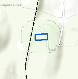
Figure 1. 1973 Sulphur Creek Trestle Fort National Register Nomination boundary.
The Sulphur Creek Trestle Battle Site is located one mile south of Elkmont, Alabama in Limestone County. The battlefield site as defined in this nomination is located on 317.018 acres of property. The area currently being nominated is an expansion of the original boundaries set forth in the 1973 Sulphur Creek Trestle Fort National Register Nomination (Figure 1).
The 1973 nomination encompassed only the fort site itself and included only 0.787 acres. The boundary expansion adds 316.231 acres for a total of 317.018 acres. The expanded boundaries of this nomination include the former location of the Sulphur Creek Trestle Bridge, the Union rifle pits located 200 yards from the fort site, the campsite of Union soldiers housed outside of the fort, the Confederate artillery positions and the probable location of Gen. Nathan Bedford Forrest's campsite the night before the attack on the fort. (Figure 2)
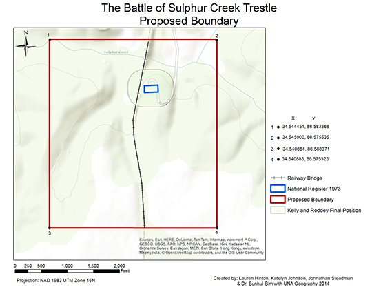
Figure 2. Proposed 2014 Sulphur Creek Trestle Fort National Register Boundary Expansion.
Download PDF.
Return to Top
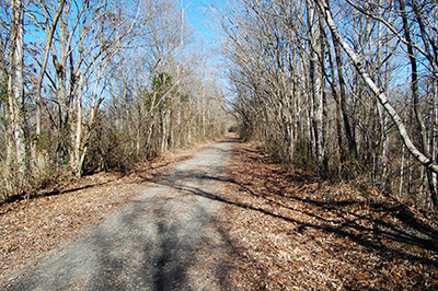
Figure 3. Former Nashville & Decatur railroad line bed, camera facing north.
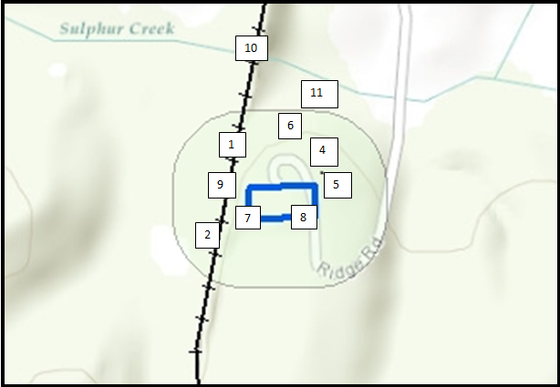
The remains of the fort sit just east of the former Nashville & Decatur railroad line (Figure 3), which ran north/south. To the east of the railroad line the current landscape is heavily wooded and to the west of the railroad line the landscape is a mix of pasture and wooded areas. While the fort site itself is much more heavily wooded than it would have been in 1864, the surrounding areas look much as they would have when the battle took place. The majority of the battlefield site has remained undeveloped. The four-bastioned earthwork fort, measuring roughly 300 feet on each side, served to protect the Nashville & Decatur railroad line as it crossed over the Sulphur Creek Trestle Bridge (the largest bridge on the Nashville & Decatur railroad line) on its way from Nashville, Tennessee to Decatur, Alabama. To protect the line through Elkmont, the fort sat at the southern end of the trestle bridge spanning Sulphur Creek to the east of the railroad line and was equipped with two 12-pound howitzers, situated in cannon embrasures at the northwest and southeast corners of the fort. Today, the property surrounding the fort site is of a mixed-used nature. A neo-Greek Revival home, pool and outbuilding (both noncontributing, 1987) sit inside the fort site. The fort's earthworks and rifle pits remain an important part of the landscape, surrounding the house and the outbuilding. The area directly surrounding the fort site is heavily wooded. The railroad tracks were removed after the use of the line ceased in 1986 and the railroad bed has been turned into a recreational trail. The property to the west of the railroad bed, where Forrest established an artillery position, is used as pasture. Despite the addition of the neo-Greek Revival house, pool and outbuilding within the fort site itself, the battle site largely retains historical integrity in terms of location, setting, feeling and association.
Return to Top
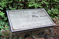
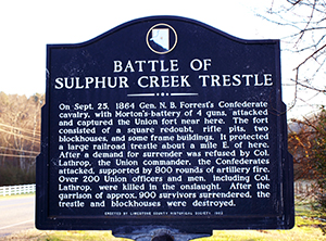
Figure 4. Interpretive panel located on the Richard Martin Trail, camera facing east.
The bulk of the Sulphur Creek Trestle Battle Site is located on private property without public access, the exception being the railroad bed, which is now part of the Richard Martin Trail and is owned by Limestone County. The Richard Martin Trail is accessible from downtown Elkmont. There is an information panel about the battle located on the trail adjacent to the fort site (approximately 1 mile from the trailhead in Elkmont) (Figure 4). There is a private home, pool and an outbuilding within the boundaries of the fort site.
Return to Top


